
NASA Clipper AIS Plotter/Radar
CLIP-AIS 1 Year Warranty
NASA Clipper AIS Plotter/Radar está agotado y se enviará tan pronto como vuelva a estar disponible.
No se ha podido cargar la disponibilidad de recogida
FAST FREE UK STANDARD SHIPPING*
FAST FREE UK STANDARD SHIPPING*
• Express delivery £7.99 (Monday-Friday, orders placed before 1pm)
• Click here for more delivery information
60 DAY NO QUIBBLE RETURNS
60 DAY NO QUIBBLE RETURNS
• 60 days hassle-free returns. - exclusions apply

NASA Clipper AIS Plotter/Radar
Descripción
Descripción
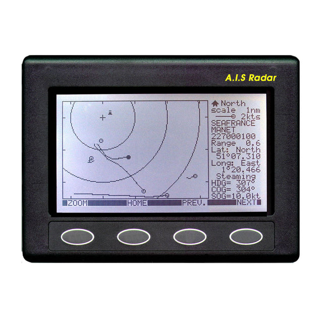
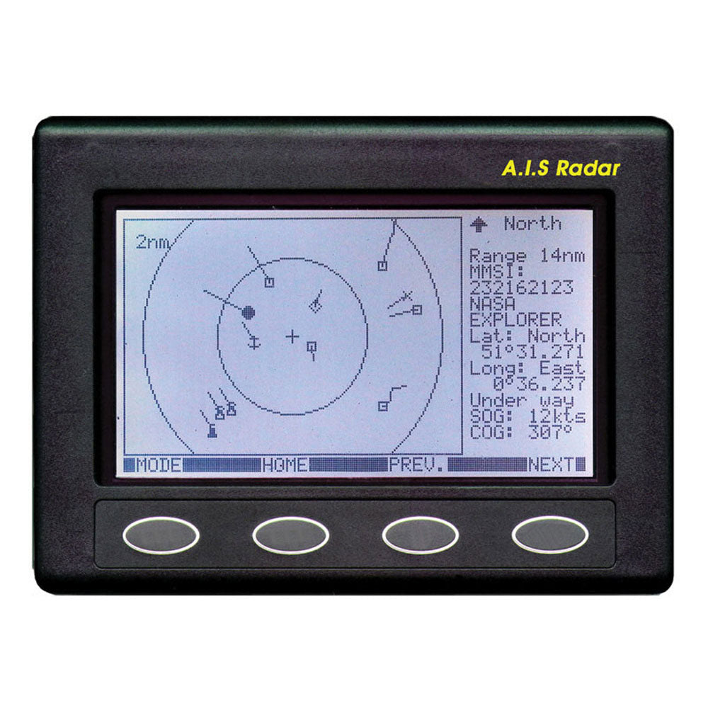
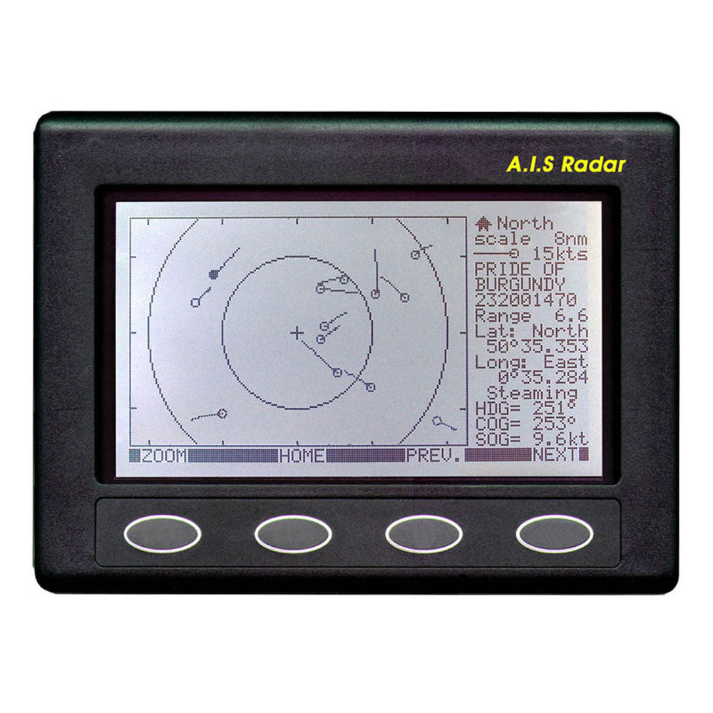
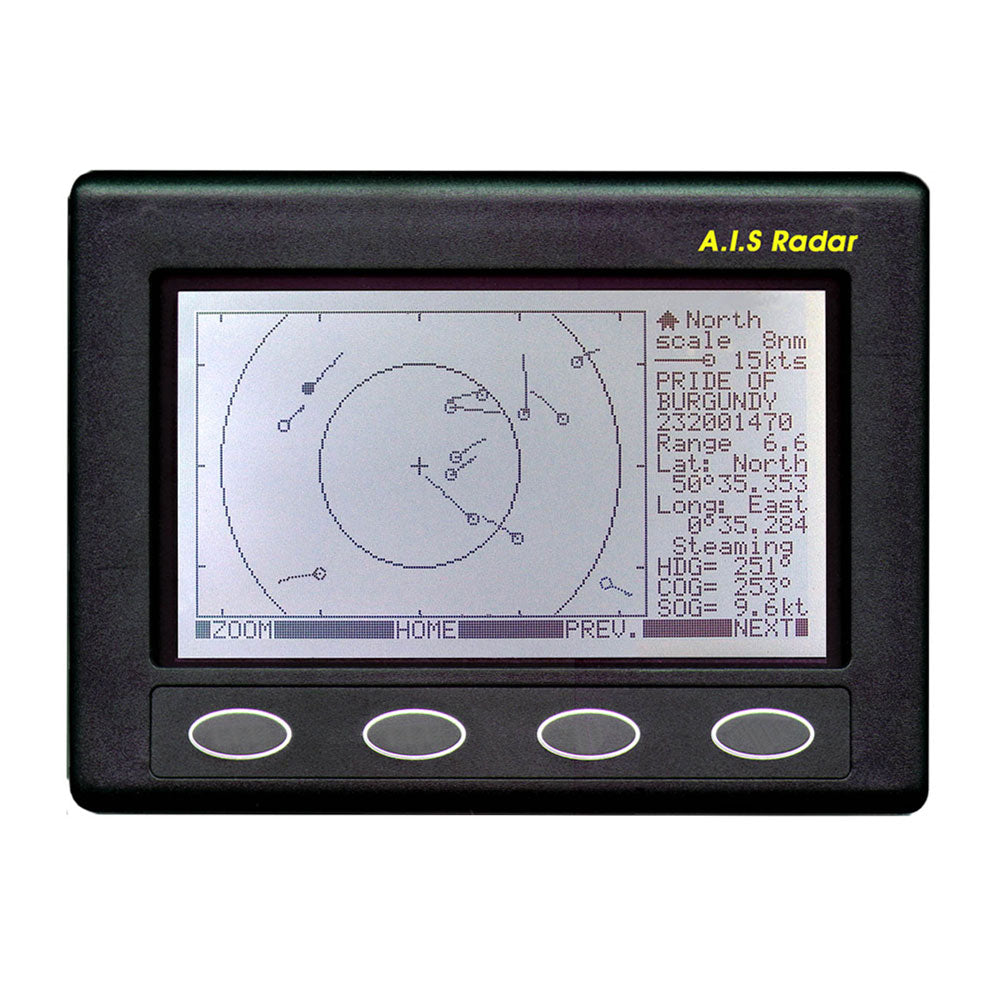
The Nasa Marine AIS radar is the first stand alone AIS receiver / plotter specifically designed for the leisure boat market. The unit consists of a dual frequency AIS receiver demodulator signal processor and a backlit matrix display. It receives an NMEA input (RMC) from the boats GPS which puts the user at the centre of a radar style screen. A COG pointer is selectable by the user. All AIS carrying vessels and SART transponders are displayed with bearing and range relative to the user. Any vessel on the screen can be selected by the user. The selected vessel is highlighted and its data displayed on the right of the screen. This data includes the vessel\'s MMSI number name course over ground speed over ground range latitude and longitude.
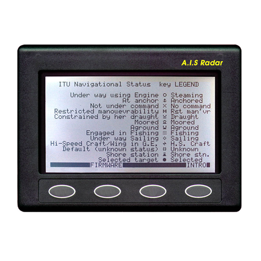
The display with ranges of 0.125 0.25 0.5 1 2 4 8 16 and 32 nautical miles shows AIS carrying vessels and SART transponders in a format normally associated with conventional radar. A trail of previous positions clearly chows the relative track of all the targets on the screen. A box to the right of the screen displays the speed over the ground the vessel name mmsi number and the latitude and longitude of any target selected by the user. As each vessel leaves a trail of previous positions the user can instantly see its relative position and bearing. Should any vessel cause concern (particularly if there is a risk of collision) it can be selected and its AIS data displayed. The MMSI number is immediately available so in the last resort a DSC call can be made directly to that vessel. If the user selects his own vessel then the screen repeats the users GPS position course and speed over ground. Each vessel’s status is shown by a different symbol so the user can see if a vessel is underway at anchor fishing etc. The compact unit has a white backlit LCD display operates from 12 volts and consumes little power.
Features
Features
Specifications
Specifications