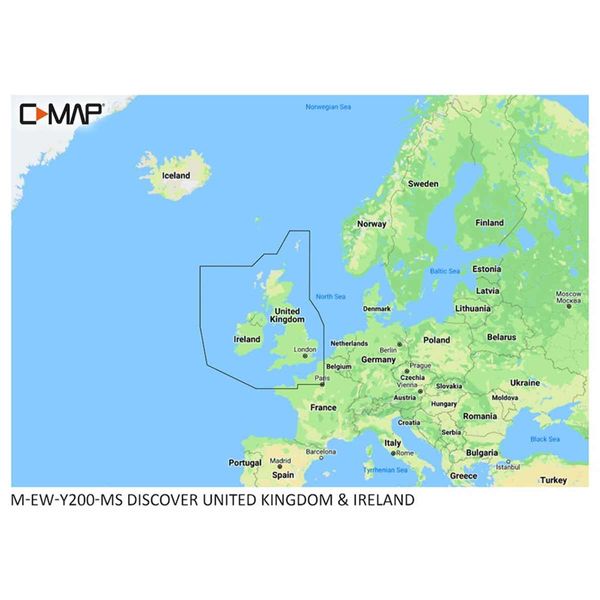
C-Map Discover M-EW-Y200-MS United Kingdom & Ireland Charts (Regular)
C-Map Discover M-EW-Y200-MS United Kingdom & Ireland Charts (Regular) est en rupture de stock et sera expédié dès qu’il sera de retour en stock.
Impossible de charger la disponibilité pour le Service de retrait
FAST FREE UK STANDARD SHIPPING*
FAST FREE UK STANDARD SHIPPING*
• Express delivery £7.99 (Monday-Friday, orders placed before 1pm)
• Click here for more delivery information
60 DAY NO QUIBBLE RETURNS
60 DAY NO QUIBBLE RETURNS
• 60 days hassle-free returns. - exclusions apply

Description
Description
C-Map Discover - United Kingdom & Ireland, The perfect mapping solution for cruisers, anglers and sailors looking for accurate, quality data and a range of coverages from the market-leader. (Purchase includes 12 months of free online updates).
Whether cruising, fishing or sailing, C-Map Discover offers a choice of coverages of all the core features you need to make the most of your time on the water. C-Map has a High-Res Bathymetry, including integrated Genesis data, along with full-featured Vector Charts, Custom Depth Shading, Tides & Currents and subscription-free Easy Routing.
Full-Featured Vector Charts – making navigation easy by giving you accurate, up-to-date vector chart detail derived from official Hydrographic Office information.
High-Res Bathymetry – HRB layer helps you identify shallow areas, drop-offs, ledges, holes or humps. Now includes compiled and quality-controlled Genesis detail as part of single layer.
Custom Depth Shading – set a clear safety depth, maintain a paper-like view or create your own custom shading.
Easy Routing – helps you automatically plot the shortest, safest route based on detailed chart data and your personalized vessel information. No subscription required.
Tides & Currents – shows projections of water level and direction of tides to help plan your day out, cruising, angling or sailing.
Detailed Marina Port Plans – docking in an unfamiliar port is no problem when you have precise layouts of thousands of marinas, including slip spaces, restricted areas and other valuable navigation information.
Harbour & Approach Details – unprecedented level of detail. Approach any harbour and inlet with confidence. The perfect conclusion to a long voyage, sailing adventure or an exciting day of fishing.
Online Updates – keep your chart up to date, with 12 months’ free online updates.
Features
Features
Specifications
Specifications


